
From 2D labels to 3D objects
Outline an object on a camera image with a box, polygon, brush or the Smart Tool, and the matching 3D object appears in the cloud.
Label LiDAR and RADAR point clouds of up to 100 million points, as single scans or whole drives, next to the camera images of the same moment. A 3D AI assistant fits cuboids, segments the ground and tracks objects, with no training on your data.
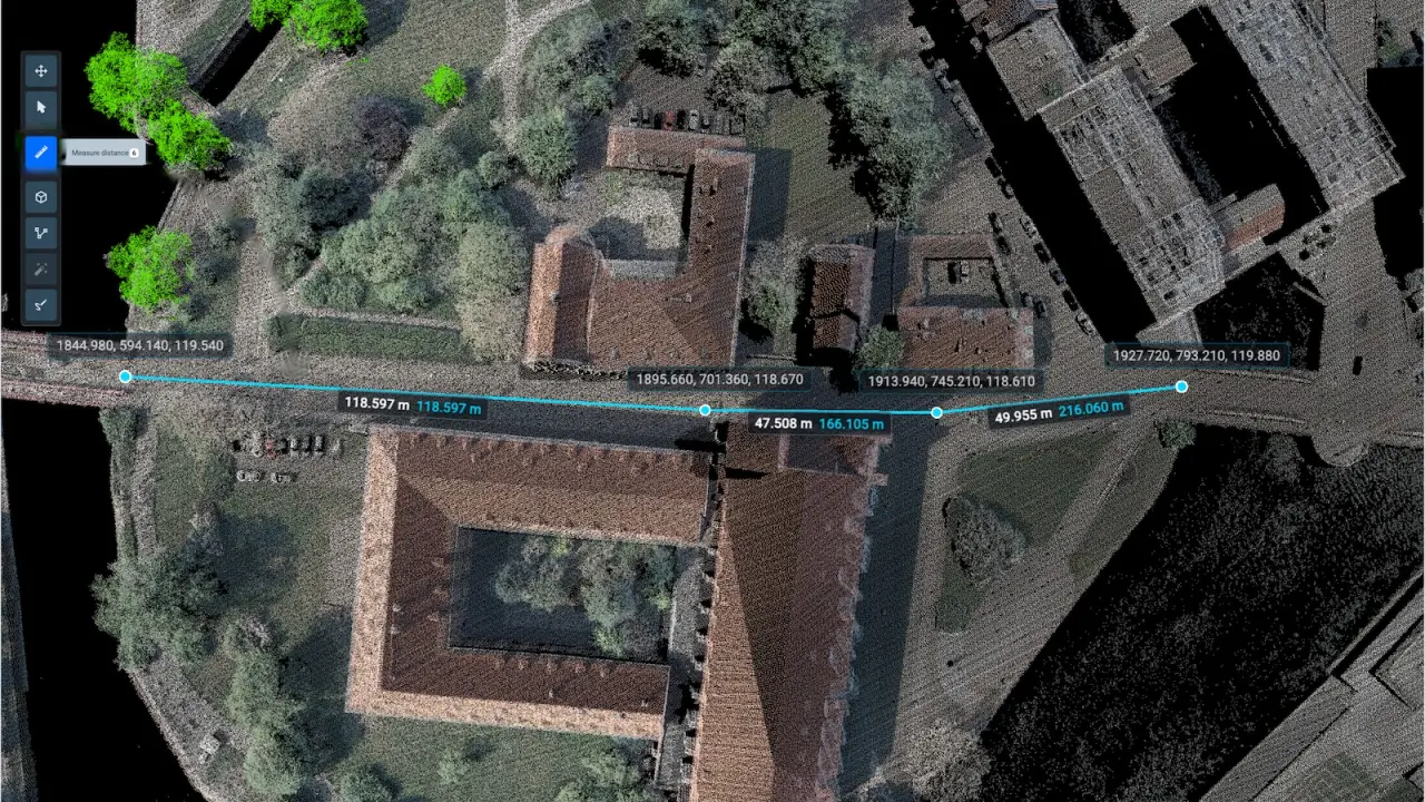
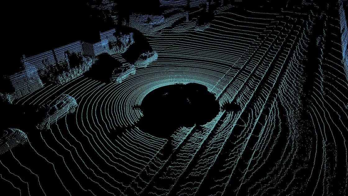
Scans render on the GPU and keep every attribute the sensor recorded, so dense automotive and aerial LiDAR is labeled at full density.
Benchmarks from the docs. WebGPU runs in current Chrome, Edge, Firefox and Safari, and the toolbox falls back to WebGL2 where it is missing. Performance for dense clouds in the docs
LAS, LAZ and PLY load as they are, with no conversion to PCD, and compressed LAZ keeps uploads small.
Intensity, return information, classification, RGB and custom fields stay with the points; ring and scan index become range filters.
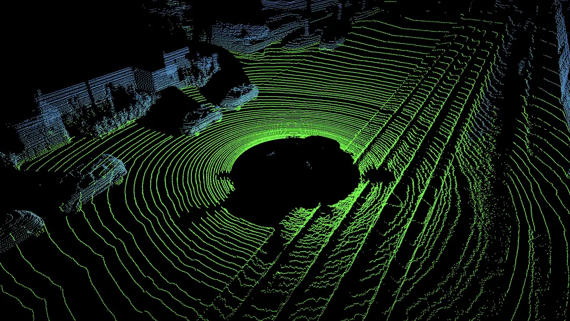
Color points by height, distance, intensity, RGB or a camera, and hide everything beyond a set distance.
The assistant is class-agnostic: objects of any shape and point density get cuboids and segments without fine-tuning on your data, so it helps from the first scan of a new project.
Click an object, and the assistant finds its points and fits a cuboid around them. Click the next one.
Circle an object, and the model places a 3D cuboid on it, in any environment and for objects it has never seen.
One click separates the ground from everything standing on it. Pick one of five algorithms, Patchwork++ and GndNet among them, and preview each on your data.
Bring your own models as well: serve MMDetection3D detectors such as CenterPoint, PV-RCNN and PointPillars to pre-label whole projects, or train them on your point clouds.
Images from one camera or a whole rig open beside the cloud with their calibration, and every 3D object is projected onto them. A label drawn on an image belongs to the same object in 3D.
Outline an object on a camera image with a box, polygon, brush or the Smart Tool, and the matching 3D object appears in the cloud.
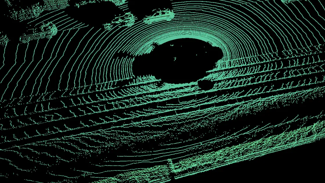
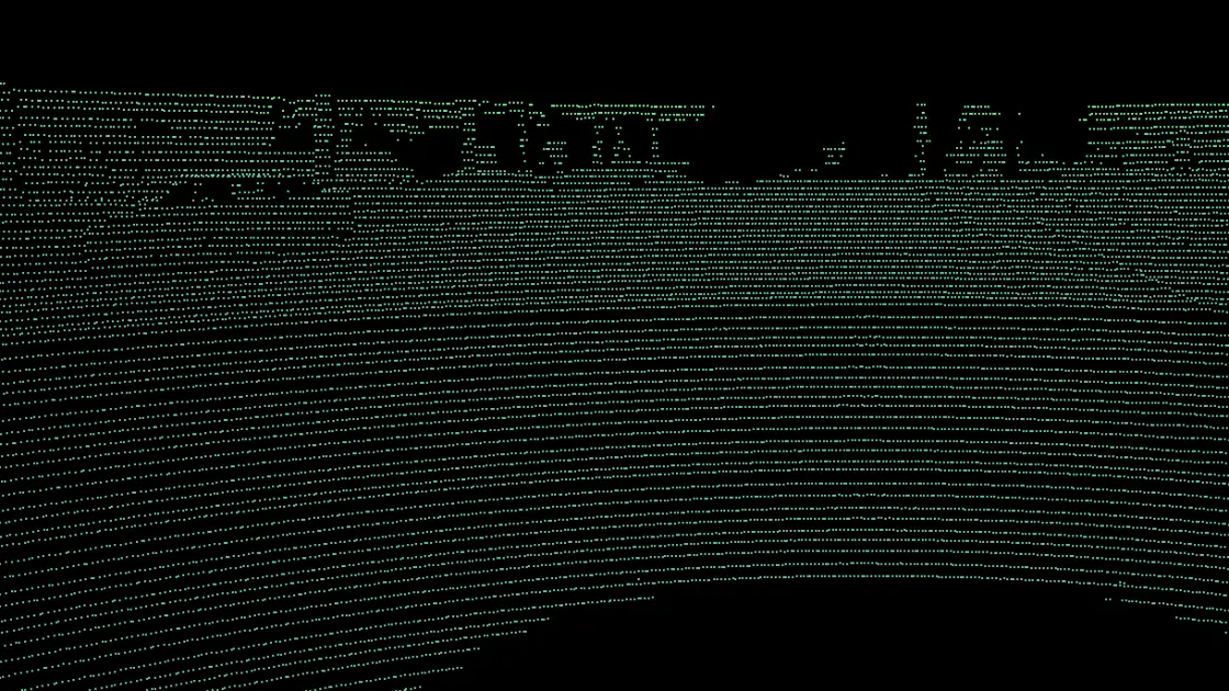
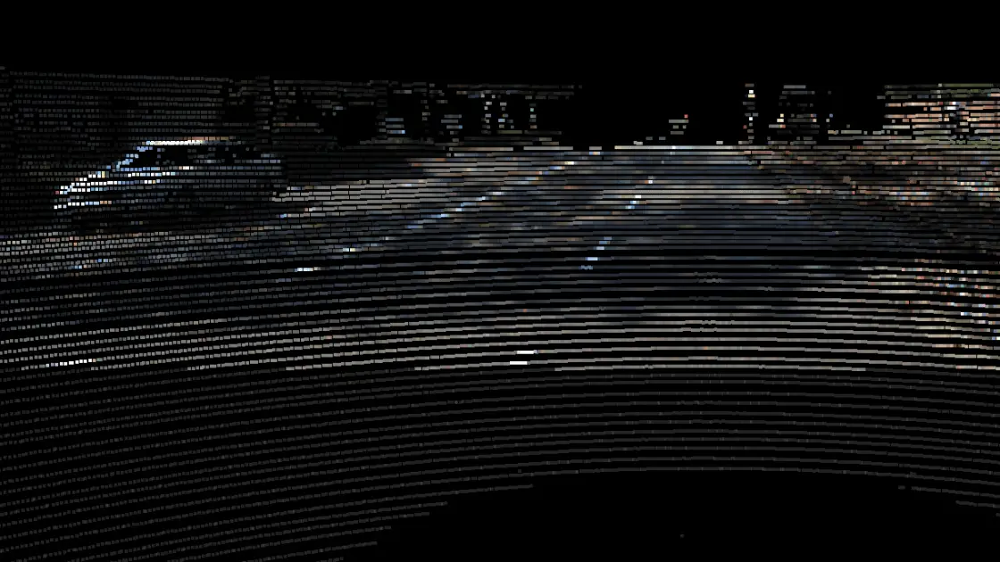
Look at the cloud from where the camera stood and paint the points with the colors of its image, in every frame of an episode, or show only the points that camera sees.
A point cloud episode plays like a video, with its cameras in sync. A cuboid placed once is tracked from scan to scan, so annotators correct a track instead of redrawing every frame.
Track one object or every object on screen forward, backward or both. Point cloud registration aligns neighboring scans, so it works on any object; interpolation fills the frames between two keyframes.
Jumping to any frame takes under a second, playback runs without stalls, and the next frames load ahead.
See where each object appears and how densely it is labeled, and tag an object for the whole episode or for a single frame.
Cuboids, point segmentation and 3D polylines for lanes and edges, checked in the Top, Side and Front views next to the 3D view.
The selected cuboid shows its length, width and height in every view, and edges hidden behind points are drawn dashed, so it is clear whether a box sits on the ground.
Segment points with one tool: click to draw a polygon, or drag to paint like a brush, to create objects or add and remove points.
Click along a road or a building edge to read the coordinates of each point, the length of every segment and the total length of the path.
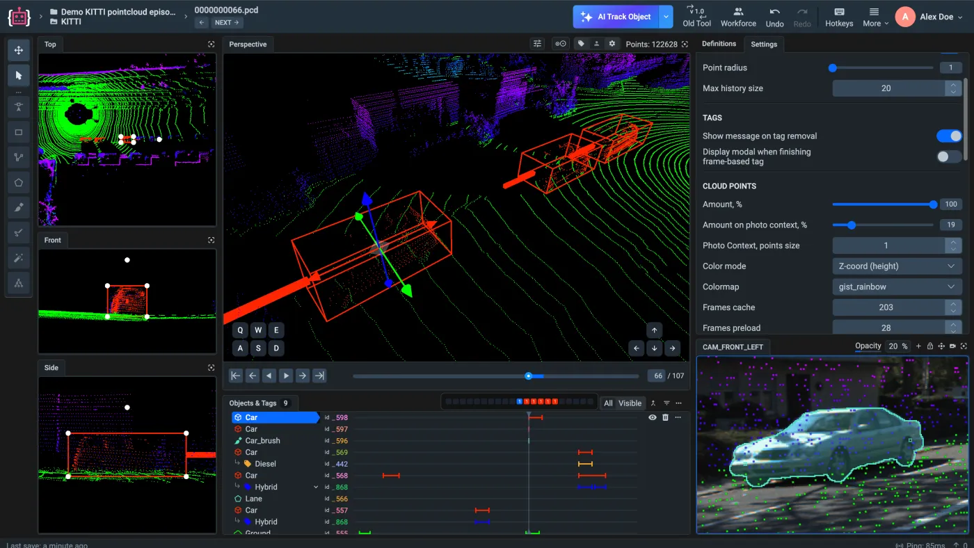
Drop a folder or an archive in: Auto Import detects the format, brings in the camera images and calibration where the format has them, and builds the project.
LAS, LAZ and PLY load natively, with no conversion to PCD, so the sensor’s own fields stay with the points.
nuScenes archives open in the official nuScenes devkit, and ROS bag export keeps the 3D cuboids.
“A very high product quality.”
BMW Group uses Supervisely to annotate manufacturing images from production lines in their world-wide plants for enhancing quality inspections using deep learning. Supervisely is integrated into the BMW Group AI Platform in order to empower computer vision based AI use cases.
 BMW Group · Manufacturing quality inspection
“Immensely grateful for their pivotal role in our work”
Working with Supervisely has significantly enhanced our capability to develop AI models for lung CT scans. What sets Supervisely apart is its exceptional support team who are really responsive and adapt to our unique needs with a range of apps and helper files.

“Helps us to do data scientist work better and faster”
We use Supervisely since 2019. The key advantage of this tool is that Supervisely provides a complete data treatment pipeline. An important advantage is that a Supervisely instance can be deployed autonomously on a Client infrastructure, and distributed on different servers.

“A valuable part of our computer vision operations”
Supervisely is a valuable part of our computer vision operations, enabling our teams to efficiently work with camera and LiDAR data across sensor fusion projects. We use Supervisely for its extensive feature set and its ability to adapt to our changing requirements.

“Extremely satisfied with Supervisely and would highly recommend it”
The review tools have been invaluable in ensuring the quality and accuracy. The Python SDK has also been incredibly helpful in automating and streamlining our workflow. The support team on Slack has been extremely helpful and responsive.

“Supervisely excels at that and much more”
We’ve been exceedingly impressed with the customer support, addition of new features, and the flexibility of the publicly available SDK/API. The Supervisely team has also been fast to respond to support questions, and has shown a lot of openness when given feedback on potential improvements.
Your team next?
Talk to a computer vision engineer about your data, your models and your infrastructure.
Book a demoLiDAR and RADAR point clouds, one scan at a time or as episodes, which are sequences of scans, together with the camera images of each frame. Objects get 3D cuboids, the Point Cloud Pen segments points, 3D polylines trace lanes and edges, and boxes, polygons, masks and the Smart Tool work on the camera images. See the 3D point cloud toolbox in the docs.
Auto Import reads PCD, PLY, LAS and LAZ files natively, and annotated datasets in KITTI 3D, KITTI-360, SemanticKITTI, nuScenes, Lyft, ROS bag and Supervisely format. Export writes Supervisely JSON, KITTI 3D, nuScenes, SemanticKITTI and ROS bags. See the supported point cloud formats.
Every frame carries its camera images with their calibration. The toolbox projects each 3D object onto the images, links a label drawn on an image to the same object in 3D, and turns a 2D box or mask into a 3D object. It can also paint the points with the colors of a camera image. See 2D to 3D projection in the docs.
No. The assistant is class-agnostic: it fits cuboids, detects objects and segments the ground for any object without fine-tuning, and its cuboid tracking aligns neighboring scans with point cloud registration instead of a trained model. You can also serve your own 3D detectors, such as MMDetection3D models. See AI for 3D point clouds in the docs.
The toolbox renders with WebGPU in the browser. In the docs benchmarks, 40 million points run at about 52 fps on a MacBook Air M4 and 100 million points at 115+ fps on a MacBook Pro (M4 Pro), and one scene holds up to 1,000 annotated objects. See performance for dense clouds.